


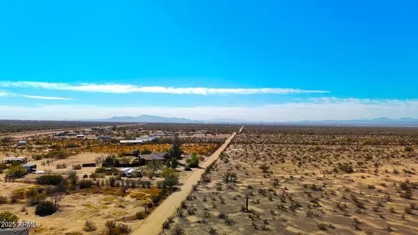


3.43 Acres Lot
3.43 Acres Lot
Key Details
Property Type Vacant Land
Listing Status Active
Purchase Type For Sale
Subdivision S18 T10S R11E
MLS Listing ID 6826166
HOA Y/N No
Originating Board Arizona Regional Multiple Listing Service (ARMLS)
Annual Tax Amount $194
Tax Year 2024
Lot Size 3.434 Acres
Acres 3.43
Property Description
GPS Coordinates: 32.558963, -111.259614
Location
State AZ
County Pinal
Community S18 T10S R11E
Zoning GR
Direction OFF I10 EXIT 226 ON E CAMINO CORREO. CONTINUE TO CAMINO ADELANTE AND TURN RIGHT HEADING SOUTHEAST. IN 5 MI. TURN LEF TON E MISSILE BASE. IN 1 MI LEFT ON MARYLYNNE LN. IN 2.5 MI PROPERTY IS ON RIGHT
Exterior
Fence Partial
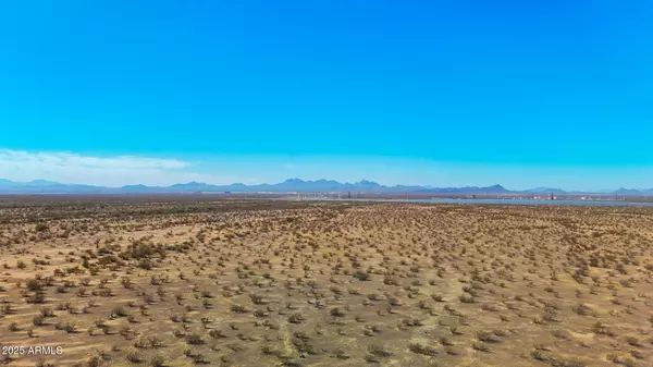
Topography Level
Building
Lot Description City Light View(s), Mountain View(s)
Sewer Sewer No SewerSeptic, Distance to Water On Property
Water Shared Well
New Construction No
Schools
Elementary Schools Red Rock Elementary School
Middle Schools Red Rock Elementary School
School District Santa Cruz Valley Union High School District
Others
Senior Community No
Tax ID 410-22-043-D
Acceptable Financing Seller Approve Terms, Seller May Carry, 1031 Exchange, Conventional
Horse Property Y
Listing Terms Seller Approve Terms, Seller May Carry, 1031 Exchange, Conventional

Copyright 2025 Arizona Regional Multiple Listing Service, Inc. All rights reserved.
GET MORE INFORMATION
Partner | Lic# SA575824000